
Objective:
Locate and travel to a benchmark that interests you.
Details:
1) Are you familiar with survey markers, commonly referred to as “benchmarks”? If not, take a bit of time to learn about them! The amount of time you spend on this step is up to you! Follow your level of interest!
You may want to start with:
This short history of survey markers.
The Wikipedia page about survey markers.
The above video, which is a little bit tongue and cheek (bordering on crass?) but interesting!
2) Identify a benchmark that is of interest to you. You can search your area with National Geodectic Survey Explorer or Geocaching’s search tool.
Note: If you are outside the US, this objective may be modified to meet your needs as you see fit. Make sure to choose an activity that involves travel and a physical marker of space and/or elevation. Let us know how you've chosen to complete this objective in the comments below.
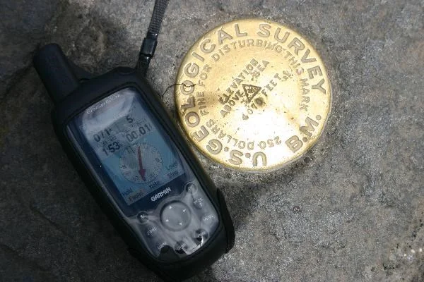
3) Travel to and find the benchmark you identified.
4) Take a photograph of your adventure (e.g. a photo of the benchmark, or yourself at the location) and post it in our Facebook group! Alternatively, or additionally, feel free to share the social media platform of your choice with the tag #QuestScouts.
Note: If there is a rule against photographing the map you may skip this requirement and explain this in the comments.
5) Along with your photo, use your post’s caption to tell us about your experience hunting for and finding a benchmark:
Where was your benchmark located?
What condition was it in?
Was it difficult to find?
Did anything interesting happen while hunting?
Alternatively, or additionally, you may complete step 3 in the comments below!